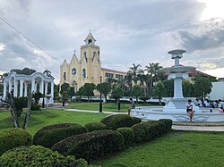
Panitan
Panitan er en kommune i den filippinske provinsen Capiz som er tilordnet landsdelen Visayas.
| Panitan | |||
|---|---|---|---|
 | |||
| Land | |||
| Status | kommune | ||
| Postnummer | 5815 | ||
| Retningsnummer | 36 | ||
| Areal | 89,88 km² | ||
| Befolkning | 42 565[1] (2020) | ||
| Bef.tetthet | 473,58 innb./km² | ||
| Antall husholdninger | 10 868 | ||
| Språk | Capisnon, Hiligaynon, tagalog | ||
| Høyde o.h. | 34 meter | ||
 Panitan 11°27′50″N 122°46′10″Ø | |||

Barangayer
redigerKommunen er inndelt i 26 barangayer.[2]
|
|
Referanser
rediger- ^ «2020 Census of Population and Housing (2020 CPH) Population Counts Declared Official by the President». folketellingen 2020. Filippinenes statistikkbyrå. 7. juli 2021.
- ^ Barangays in Panitan 2018 Philippine Standard Geographic Code (PSGC)
Kilder
rediger- 2018 Philippine Standard Geographic Code (PSGC) Philippine Statistics Authority