Fil:Wfm loch leven.png
Størrelse på denne forhåndsvisningen: 800 × 593 piksler. Andre oppløsninger: 320 × 237 piksler | 640 × 474 piksler | 1 024 × 758 piksler | 1 280 × 948 piksler.
Opprinnelig fil (1 280 × 948 piksler, filstørrelse: 2,37 MB, MIME-type: image/png)
| Denne filen er fra Wikimedia Commons og kan brukes av andre prosjekter. Informasjonen fra filbeskrivelsessiden vises nedenfor. |
| Beskrivelse |
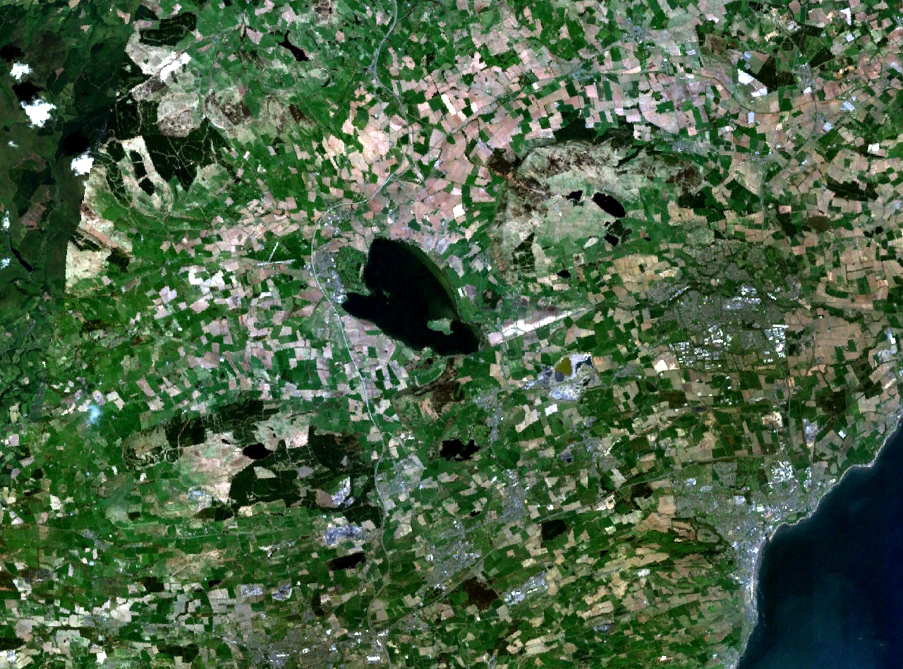
Loch Leven and central Fife in Scotland. Kirkcaldy is visible on the coast to the southeast, Glenrothes to the east, and part of Dunfermline to the south. The M90 motorway runs to the west, through Kinross and past Milnathort. |
|||
| Dato | Ukjent dato (montage of various photgraphs) | |||
| Kilde | NASA World Wind | |||
| Opphavsperson | NASA Landsat | |||
| Tillatelse (Gjenbruk av denne filen) |
|

Filhistorikk
Klikk på et tidspunkt for å vise filen slik den var på det tidspunktet.
| Dato/klokkeslett | Miniatyrbilde | Dimensjoner | Bruker | Kommentar | |
|---|---|---|---|---|---|
| nåværende | 16. apr. 2006 kl. 19:37 | | 1 280 × 948 (2,37 MB) | Finlay McWalter | {{Information| |Description=Loch Leven and western Fife in Scotland |Source=NASA World Wind |Date=unknown (montage of various photgraphs) |Author=NASA Landsat |Permission={{PD-WorldWind}} |other_versions= }} |
Filbruk
Den følgende siden bruker denne filen:
Global filbruk
Følgende andre wikier bruker denne filen:
- Bruk i af.wikipedia.org
- Bruk i de.wikipedia.org
- Bruk i en.wikipedia.org
- Bruk i eu.wikipedia.org
- Bruk i fr.wikipedia.org
- Bruk i ru.wikipedia.org
- Bruk i sv.wikipedia.org
- Bruk i uk.wikipedia.org