Fil:Topography of new zealand.jpg

Størrelse på denne forhåndsvisningen: 465 × 599 piksler. Andre oppløsninger: 186 × 240 piksler | 540 × 696 piksler.
Opprinnelig fil (540 × 696 piksler, filstørrelse: 86 KB, MIME-type: image/jpeg)
| Denne filen er fra Wikimedia Commons og kan brukes av andre prosjekter. Informasjonen fra filbeskrivelsessiden vises nedenfor. |

|
This map has been uploaded by Electionworld from en.wikipedia.org to enable the |
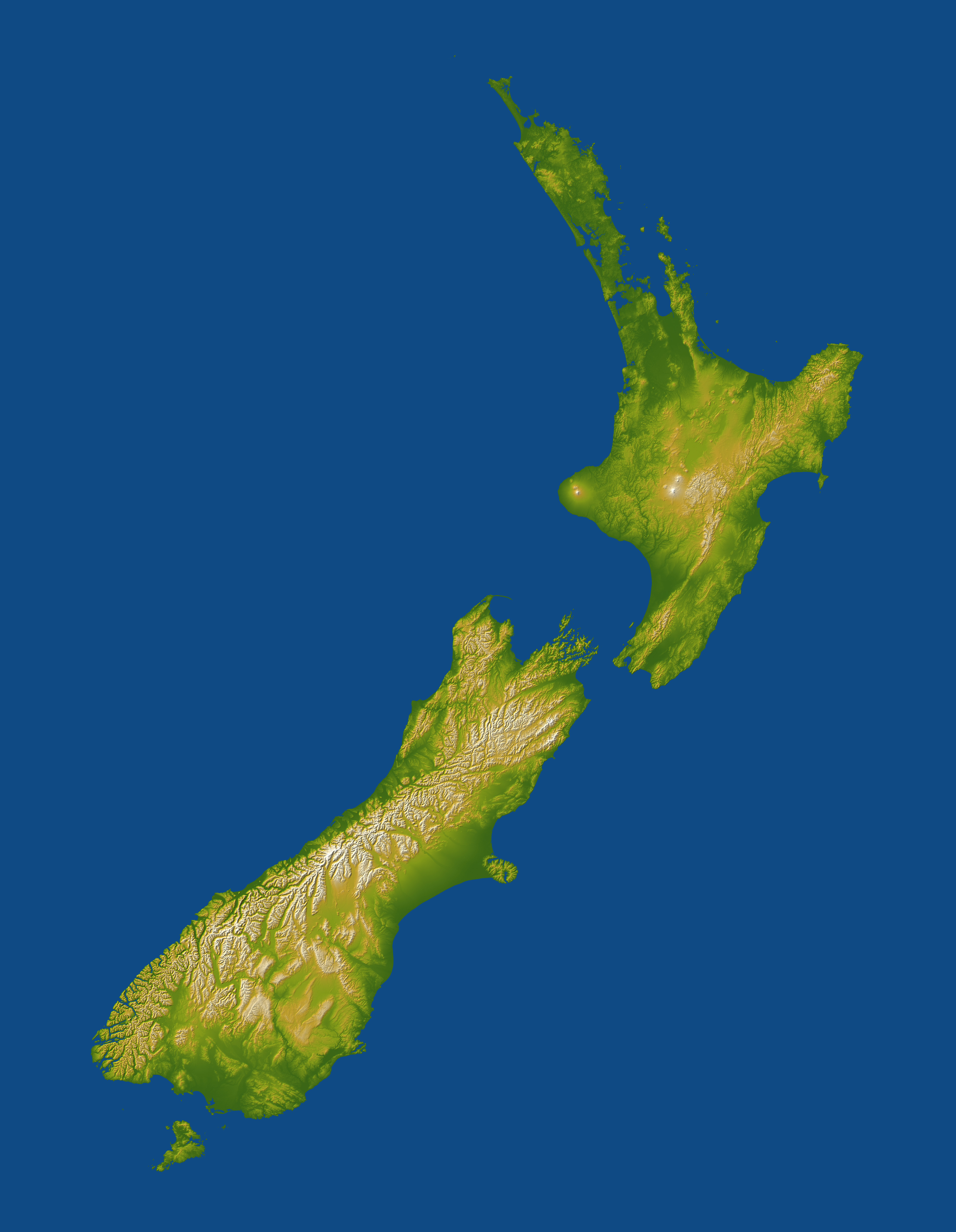
Topography of New Zealand. Lakes appear as flat areas but are not otherwise indicated.
For image description, see here.
For larger version, see here.
Image credit: NASA/JPL-Caltech
This image or video was catalogued by Jet Propulsion Laboratory of the United States National Aeronautics and Space Administration (NASA) under Photo ID: PIA06662. This tag does not indicate the copyright status of the attached work. A normal copyright tag is still required. See Commons:Licensing. Other languages:
|
| This file is in the public domain in the United States because it was solely created by NASA. NASA copyright policy states that "NASA material is not protected by copyright unless noted". (See Template:PD-USGov, NASA copyright policy page or JPL Image Use Policy.) | ||
 |
Warnings:
|
Filhistorikk
Klikk på et tidspunkt for å vise filen slik den var på det tidspunktet.
| Dato/klokkeslett | Miniatyrbilde | Dimensjoner | Bruker | Kommentar | |
|---|---|---|---|---|---|
| nåværende | 30. nov. 2006 kl. 01:10 | | 540 × 696 (86 KB) | Electionworld | {{ew|en|Darwinek}} Topography of New Zealand for image description see [http://earthobservatory.nasa.gov/Newsroom/NewImages/images.php3?img_id=16812 here] for larger version see [http://earthobservatory.nasa.gov/Newsroom/NewImages/Images/PIA06662_lrg.jp |
Filbruk
Den følgende siden bruker denne filen:
Global filbruk
Følgende andre wikier bruker denne filen:
- Bruk i ar.wikipedia.org
- Bruk i ast.wikipedia.org
- Bruk i ca.wikipedia.org
- Bruk i ceb.wikipedia.org
- Bruk i cy.wikipedia.org
- Bruk i de.wikipedia.org
- Bruk i eo.wikipedia.org
- Bruk i es.wikipedia.org
- Bruk i et.wikipedia.org
- Bruk i eu.wikipedia.org
- Bruk i fr.wikipedia.org
- Bruk i gl.wikipedia.org
- Bruk i hif.wikipedia.org
- Bruk i ja.wikipedia.org
- Bruk i ka.wikipedia.org
- Bruk i nl.wikipedia.org
- Bruk i ta.wikipedia.org
- Bruk i uk.wikipedia.org
- Bruk i wuu.wikipedia.org