Fil:The road to the Lighthouse, Mull of Kintyre - geograph.org.uk - 484739.jpg
Ingen høyere oppløsning tilgjengelig.
The_road_to_the_Lighthouse,_Mull_of_Kintyre_-_geograph.org.uk_-_484739.jpg (640 × 480 piksler, filstørrelse: 70 KB, MIME-type: image/jpeg)
| Denne filen er fra Wikimedia Commons og kan brukes av andre prosjekter. Informasjonen fra filbeskrivelsessiden vises nedenfor. |
Beskrivelse
| Beskrivelse |
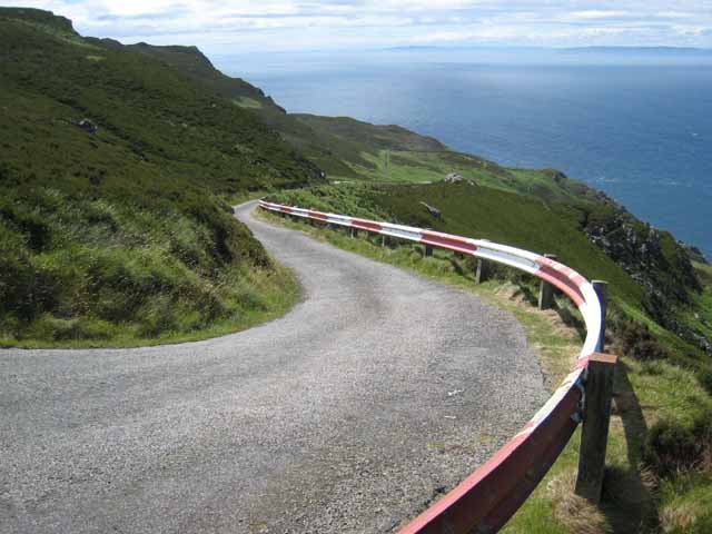
English: The road to the Lighthouse, Mull of Kintyre A tortuous public road leads up to the Gap. Beyond there, an even steeper and more tortuous private road leads down the precipitous hillside to the lighthouse at the Mull of Kintyre. Rathlin Island (Northern Ireland) can be clearly seen on the horizon. |
| Dato | |
| Kilde | From geograph.org.uk |
| Opphavsperson | Oliver Dixon |
| Navngivelse (påkravd av lisensen) | Oliver Dixon / The road to the Lighthouse, Mull of Kintyre / |
| Kameraposisjon | | Dette og andre bilder på denne posisjonen på: OpenStreetMap |
|---|
_heading:202.00&language=nb)
| Objektposisjon | | Dette og andre bilder på denne posisjonen på: OpenStreetMap |
|---|
_heading:202.00&language=nb)
Lisensiering

|
This image was taken from the Geograph project collection. See this photograph's page on the Geograph website for the photographer's contact details. The copyright on this image is owned by Oliver Dixon and is licensed for reuse under the Creative Commons Attribution-ShareAlike 2.0 license.
|
Denne filen er lisensiert under lisensen Creative Commons Navngivelse-DelPåSammeVilkår 2.0 Generisk
Navngivelse: Oliver Dixon
- Du står fritt:
- til å dele – til å kopiere, distribuere og overføre verket
- til å blande – til å endre verket
- Under de følgende betingelsene:
- navngivelse – Du må kreditere verket på passende vis, lenke til lisensen og indikere hvorvidt det har blitt gjort endringer. Du kan gjøre det på enhver rimelig måte, men ikke på en måte som antyder at lisensgiveren støtter deg eller din bruk av verket.
- del på samme vilkår – Dersom du remikser, omarbeider eller på annen måte bygger på dette verket, må du kun distribuere resultatet under den samme eller en samsvarende lisens som denne.
Filhistorikk
Klikk på et tidspunkt for å vise filen slik den var på det tidspunktet.
| Dato/klokkeslett | Miniatyrbilde | Dimensjoner | Bruker | Kommentar | |
|---|---|---|---|---|---|
| nåværende | 5. feb. 2011 kl. 05:01 | | 640 × 480 (70 KB) | GeographBot | == {{int:filedesc}} == {{Information |description={{en|1=The road to the Lighthouse, Mull of Kintyre A tortuous public road leads up to the Gap. Beyond there, an even steeper and more tortuous private road leads down the precipitous hillside to the lighth |
Filbruk
Den følgende siden bruker denne filen:
Global filbruk
Følgende andre wikier bruker denne filen: