Fil:ScotlandEastLothian.png
Ingen høyere oppløsning tilgjengelig.
ScotlandEastLothian.png (200 × 230 piksler, filstørrelse: 4 KB, MIME-type: image/png)
| Denne filen er fra Wikimedia Commons og kan brukes av andre prosjekter. Informasjonen fra filbeskrivelsessiden vises nedenfor. |
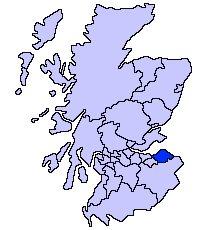
East Lothian unitary council
Slightly edited version of a map drawn by Morwen

|
Det tillates at dette dokumentet kopieres, distribueres og/eller modifiseres under retningslinjene som beskrevet i GNU fri dokumentasjonslisens, versjon 1.2 eller senere utgave utgitt av Free Software Foundation; med alle seksjoner, uten noen forsidetekster og baksidetekster. En kopi av lisensen er inkludert i avsnittet GNU Free Documentation License. |
| Denne filen er lisensiert under lisensen Creative Commons Navngivelse-DelPåSammeVilkår 3.0 Unported | ||
| ||
| Dette lisensmerket ble lagt til filen som del av lisensoppdateringen av GFDL. |
Filhistorikk
Klikk på et tidspunkt for å vise filen slik den var på det tidspunktet.
| Dato/klokkeslett | Miniatyrbilde | Dimensjoner | Bruker | Kommentar | |
|---|---|---|---|---|---|
| nåværende | 17. mai 2005 kl. 23:33 | | 200 × 230 (4 KB) | Voyager | East Lothian unitary council Slightly edited version of a map drawn by Morwen {{GFDL}} Category:Maps of Scottish unitary councils |
Filbruk
Den følgende siden bruker denne filen:
Global filbruk
Følgende andre wikier bruker denne filen:
- Bruk i ar.wikipedia.org
- Bruk i ast.wikipedia.org
- Bruk i be.wikipedia.org
- Bruk i bg.wikipedia.org
- Bruk i ca.wikipedia.org
- Bruk i cy.wikipedia.org
- Bruk i da.wikipedia.org
- Bruk i de.wikipedia.org
- Bruk i en.wikipedia.org
- Bruk i eu.wikipedia.org
- Ekialdeko Lothian
- Lankide:Euskaldunaa
- Haddington (Eskozia)
- Musselburgh
- Dunbar
- Txantiloi:Ekialdeko Lothian
- Aberlady
- Athelstaneford
- Auldhame eta Scoughall
- Bolton (Ekialdeko Lothian)
- Cockenzie eta Port Seton
- Dirleton
- Drem
- East Linton
- Whitekirk eta Tyninghame
- Wallyford
- East Saltoun eta West Saltoun
- Gifford (Ekialdeko Lothian)
- Gullane
- Wikiproiektu:Irlanda, Gales eta Eskoziako udalerriak
- Ballencrieff (Ekialdeko Lothian)
- North Berwick
- Prestonpans
- Tranent
- Bara (Ekialdeko Lothian)
- Belhaven (Eskozia)
- Biel (Ekialdeko Lothian)
- Bilsdean
- Broxburn (Ekialdeko Lothian)
- Canty Bay
- Carberry (Ekialdeko Lothian)
- Dunglass
- East Fortune
- Elphinstone (Ekialdeko Lothian)
- Garvald (Ekialdeko Lothian)
- Gladsmuir
- Humbie
- Innerwick
- Inveresk
Vis mer global bruk av denne filen.