Fil:Sand Mountain volcanic field.jpg
Ingen høyere oppløsning tilgjengelig.
Sand_Mountain_volcanic_field.jpg (640 × 422 piksler, filstørrelse: 32 KB, MIME-type: image/jpeg)
| Denne filen er fra Wikimedia Commons og kan brukes av andre prosjekter. Informasjonen fra filbeskrivelsessiden vises nedenfor. |
| Beskrivelse |
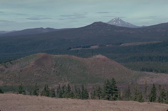
English: The Sand Mountain volcanic field contains a group of 23 cinder cones erupted along a N-S line NW of Mount Washington.
|
|||
| Dato | ||||
| Kilde | http://www.volcano.si.edu/world/volcano.cfm?vnum=1202-04-&volpage=photos&photo=030029 | |||
| Opphavsperson | Lee Siebert (Smithsonian Institution) | |||
| Tillatelse (Gjenbruk av denne filen) |
|
Filhistorikk
Klikk på et tidspunkt for å vise filen slik den var på det tidspunktet.
| Dato/klokkeslett | Miniatyrbilde | Dimensjoner | Bruker | Kommentar | |
|---|---|---|---|---|---|
| nåværende | 27. mai 2010 kl. 18:00 | | 640 × 422 (32 KB) | Michael Metzger | {{Information |Description={{en|1=The Sand Mountain volcanic field contains a group of 23 cinder cones erupted along a N-S line NW of Mount Washington. Two cone alignments diverge at the highest cone, Sand Mountain; this view looks along the NNE alignment |
Filbruk
Den følgende siden bruker denne filen:
Global filbruk
Følgende andre wikier bruker denne filen:
- Bruk i de.wikipedia.org
- Bruk i en.wikipedia.org
- Bruk i pt.wikipedia.org
- Bruk i www.wikidata.org