Fil:NepalBajuraDistrictmap.png
Opprinnelig fil (2 479 × 3 508 piksler, filstørrelse: 249 KB, MIME-type: image/png)
| Denne filen er fra Wikimedia Commons og kan brukes av andre prosjekter. Informasjonen fra filbeskrivelsessiden vises nedenfor. |
| Beskrivelse |
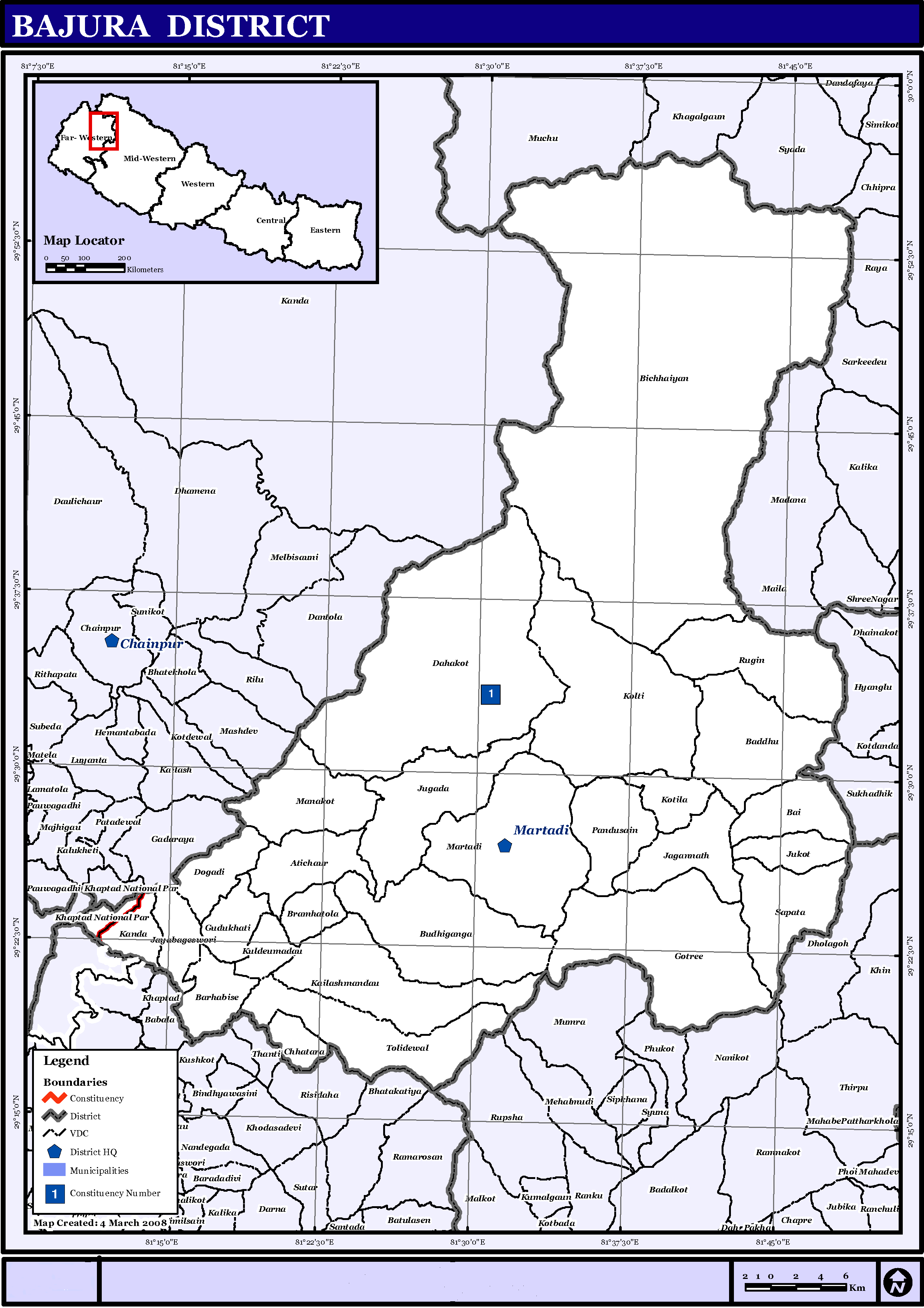
English: Map displaying Village Development Committees in Bajura District, Nepal |
|||
| Dato | ||||
| Kilde | http://www.un.org.np/maps/district-maps/far-western/Bajura.pdf | |||
| Opphavsperson | United Nations | |||
| Tillatelse (Gjenbruk av denne filen) |
|

Filhistorikk
Klikk på et tidspunkt for å vise filen slik den var på det tidspunktet.
| Dato/klokkeslett | Miniatyrbilde | Dimensjoner | Bruker | Kommentar | |
|---|---|---|---|---|---|
| nåværende | 21. mai 2016 kl. 17:21 | | 2 479 × 3 508 (249 KB) | Timeshifter | Removed UN logo and info. Only UN maps without UN info are allowed. |
| 6. nov. 2008 kl. 03:40 |  | 2 479 × 3 508 (272 KB) | Sadalmelik | {{Information |Description={{en|1=Map displaying Village Development Committees in Bajura District, Nepal}} |Source=http://www.un.org.np/maps/district-maps/far-western/Bajura.pdf |Date=March 4, 2008 |Author=United Nations |Permission={{PD-UN}} |other_ |
Filbruk
Den følgende siden bruker denne filen:
Global filbruk
Følgende andre wikier bruker denne filen:
- Bruk i de.wikipedia.org
- Bruk i en.wikipedia.org
- Bruk i fi.wikipedia.org
- Bruk i it.wikipedia.org
- Bruk i mai.wikipedia.org
- Bruk i ms.wikipedia.org
- Bruk i ne.wikipedia.org
Vis mer global bruk av denne filen.