Fil:MountDutton.jpg
Størrelse på denne forhåndsvisningen: 800 × 534 piksler. Andre oppløsninger: 320 × 214 piksler | 640 × 428 piksler | 1 024 × 684 piksler.
Opprinnelig fil (1 024 × 684 piksler, filstørrelse: 151 KB, MIME-type: image/jpeg)
| Denne filen er fra Wikimedia Commons og kan brukes av andre prosjekter. Informasjonen fra filbeskrivelsessiden vises nedenfor. |
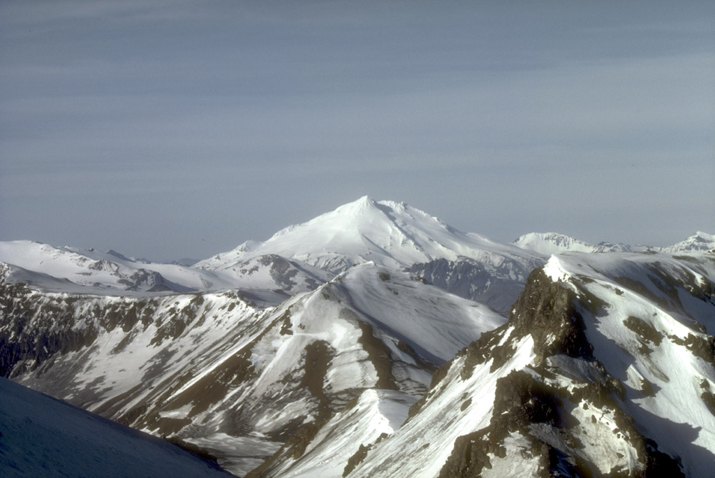
Mount Dutton, a 1,506-m (4,941 ft)-high stratovolcano, lies 14 km (9 mi) north of the community of King Cove on the Alaska Peninsula. The summit of Mount Dutton is composed of a cluster of lava domes. Mount Dutton has had no historical eruptions. However, seismic swarms beneath the volcano were recorded in 1984 to 1985 and again in 1989. View is to the southwest.
Photograph by M.E. Yount, U.S. Geological Survey, July, 1986.
Source: http://geopubs.wr.usgs.gov/dds/dds-40/
This image is in the public domain in the United States because it only contains materials that originally came from the United States Geological Survey, an agency of the United States Department of the Interior. For more information, see the official USGS copyright policy.
|
Filhistorikk
Klikk på et tidspunkt for å vise filen slik den var på det tidspunktet.
| Dato/klokkeslett | Miniatyrbilde | Dimensjoner | Bruker | Kommentar | |
|---|---|---|---|---|---|
| nåværende | 27. jan. 2005 kl. 11:21 | | 1 024 × 684 (151 KB) | GarciaB~commonswiki | Mount Dutton, Alaska |
Filbruk
Den følgende siden bruker denne filen:
Global filbruk
Følgende andre wikier bruker denne filen:
- Bruk i arz.wikipedia.org
- Bruk i ceb.wikipedia.org
- Bruk i cs.wikipedia.org
- Bruk i de.wikipedia.org
- Bruk i en.wikipedia.org
- Bruk i lld.wikipedia.org
- Bruk i ms.wikipedia.org
- Bruk i ru.wikipedia.org
- Bruk i ur.wikipedia.org
- Bruk i www.wikidata.org
- Bruk i zh.wikipedia.org