Fil:Map of Washington highlighting Spokane County.svg

Størrelse for denne PNG-forhåndsvisningen av denne SVG-filen: 800 × 521 piksler Andre oppløsninger: 320 × 208 piksler | 640 × 417 piksler | 1 024 × 667 piksler | 1 280 × 833 piksler | 2 560 × 1 666 piksler | 1 696 × 1 104 piksler.
Opprinnelig fil (SVG-fil, standardstørrelse 1 696 × 1 104 piksler, filstørrelse: 109 KB)
| Denne filen er fra Wikimedia Commons og kan brukes av andre prosjekter. Informasjonen fra filbeskrivelsessiden vises nedenfor. |
Beskrivelse
| Beskrivelse |
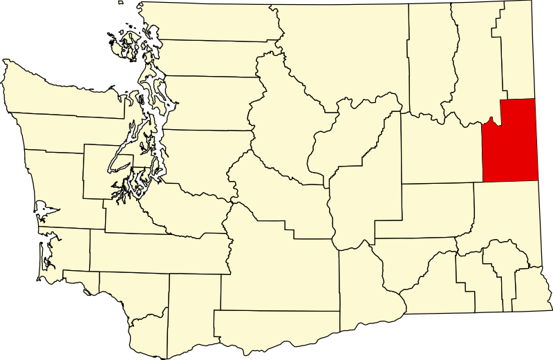
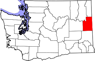
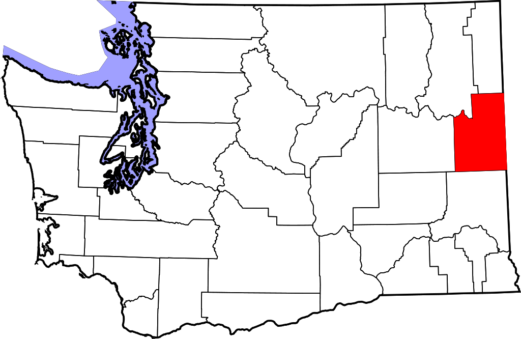
English: This is a locator map showing Spokane County in Washington. For more information, see Commons:United States county locator maps. |
| Dato | |
| Kilde |
Eget verk: English: The maps use data from nationalatlas.gov, specifically countyp020.tar.gz on the Raw Data Download page. The maps also use state outline data from statesp020.tar.gz. The Florida maps use hydrogm020.tar.gz to display Lake Okeechobee. |
| Opphavsperson | David Benbennick |
Lisensiering
| Jeg, opphavsrettensholderen til dette verket, frigir dette verket til allmennheten. Dette gjelder på verdensbasis. I enkelte land kan dette være juridisk umulig. I så fall: Jeg gir hvem som helst retten til å bruke dette verket for ethvert formål, uten noen vilkår, med mindre slike vilkår kreves ved lov. |
Filhistorikk
Klikk på et tidspunkt for å vise filen slik den var på det tidspunktet.
| Dato/klokkeslett | Miniatyrbilde | Dimensjoner | Bruker | Kommentar | |
|---|---|---|---|---|---|
| nåværende | 25. jun. 2024 kl. 01:43 | | 1 696 × 1 104 (109 KB) | Nux | fix rendering (remove clipping) |
| 12. feb. 2006 kl. 20:06 |  | 5 936 × 3 863 (215 KB) | David Benbennick | {{subst:User:Dbenbenn/clm|county=Spokane County|state=Washington|type=county}} |
Filbruk
De følgende 2 sidene bruker denne filen:
Global filbruk
Følgende andre wikier bruker denne filen:
- Bruk i ar.wikipedia.org
- Bruk i bg.wikipedia.org
- Bruk i bpy.wikipedia.org
- Bruk i ca.wikipedia.org
- Spokane (Washington)
- Airway Heights
- Cheney (Washington)
- Country Homes
- Deer Park (Washington)
- Fairfield (Washington)
- Fairwood (comtat de Spokane)
- Latah (Washington)
- Liberty Lake
- Medical Lake
- Millwood (Washington)
- Otis Orchards-East Farms
- Rockford (Washington)
- Spangle
- Town and Country (Washington)
- Waverly (Washington)
- Plantilla:Comtat de Spokane
- Amber (Washington)
- Bruk i cdo.wikipedia.org
- Bruk i ceb.wikipedia.org
- Bruk i ce.wikipedia.org
- Bruk i cs.wikipedia.org
- Bruk i cy.wikipedia.org
- Bruk i de.wikipedia.org
Vis mer global bruk av denne filen.