Fil:Lake Kamo Aerial photograph.1976.jpg

Størrelse på denne forhåndsvisningen: 628 × 600 piksler. Andre oppløsninger: 251 × 240 piksler | 503 × 480 piksler | 804 × 768 piksler | 1 072 × 1 024 piksler | 2 144 × 2 048 piksler | 8 830 × 8 433 piksler.
Opprinnelig fil (8 830 × 8 433 piksler, filstørrelse: 48,05 MB, MIME-type: image/jpeg)
| Denne filen er fra Wikimedia Commons og kan brukes av andre prosjekter. Informasjonen fra filbeskrivelsessiden vises nedenfor. |
Beskrivelse
| Beskrivelse |
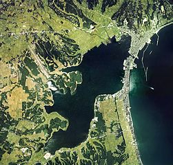
English: Lake Kamo Aerial photograph.1976
日本語: 加茂湖(新潟県佐渡市)の空中写真。ccb-76-1_c13の13,14,15,16,17、ccb-76-1_c14の13,14,15,16,17,18、ccb-76-1_c15の26,27,28,29,30、合計16枚を合成作成。 |
| Dato | |
| Kilde | 国土情報ウェブマッピングシステム |
| Opphavsperson | 国土交通省 |
Lisensiering

|
Denne filens rettighetsinnehaver, the Ministry of Land, Infrastructure, Transport and Tourism of Japan, tillater alle å bruke filen til ethvert formål, forutsatt at rettighetsinnehaver blir korrekt kreditert. Redistribusjon, bearbeidelser, kommersiell bruk, og alle andre anvendelser er tillatt. |
Navngivelse:
Copyright © National Land Image Information (Color Aerial Photographs), Ministry of Land, Infrastructure, Transport and Tourism
|
 |
This image is copyrighted by the Ministry of Land, Infrastructure, Transport and Tourism of Japan. For terms of use, see the stipulation to use of National Land Information (in Japanese) and message from MLIT (in Japanese and English). When you display this image on an article, include the following phrase in the description: "Made based on National Land Image Information (Color Aerial Photographs), Ministry of Land, Infrastructure, Transport and Tourism".
|
Filhistorikk
Klikk på et tidspunkt for å vise filen slik den var på det tidspunktet.
| Dato/klokkeslett | Miniatyrbilde | Dimensjoner | Bruker | Kommentar | |
|---|---|---|---|---|---|
| nåværende | 15. jan. 2014 kl. 09:54 | | 8 830 × 8 433 (48,05 MB) | さかおり | {{Information |Description ={{en|1=Lake Kamo Aerial photograph.1976}} {{ja|1=加茂湖(新潟県佐渡市)の空中写真。ccb-76-1_c13の13,14,15,16,17、ccb-76-1_c14の13,14,15,16,17,18、ccb-76-1_c15の26,27,28,29,30、合計16枚を合成�... |
Filbruk
Global filbruk
Følgende andre wikier bruker denne filen:
- Bruk i ceb.wikipedia.org
- Bruk i de.wikivoyage.org
- Bruk i en.wikipedia.org
- Bruk i ja.wikipedia.org
- Bruk i tr.wikipedia.org
- Bruk i www.wikidata.org
- Bruk i zh.wikipedia.org