Fil:Karta över Sankt Petersburg på 1910-talet (ur Nordisk familjebok).jpg

Størrelse på denne forhåndsvisningen: 800 × 594 piksler. Andre oppløsninger: 320 × 238 piksler | 640 × 475 piksler | 1 024 × 760 piksler | 1 280 × 950 piksler | 2 560 × 1 901 piksler | 3 432 × 2 548 piksler.
Opprinnelig fil (3 432 × 2 548 piksler, filstørrelse: 2,2 MB, MIME-type: image/jpeg)
| Denne filen er fra Wikimedia Commons og kan brukes av andre prosjekter. Informasjonen fra filbeskrivelsessiden vises nedenfor. |
Beskrivelse
| Beskrivelse |
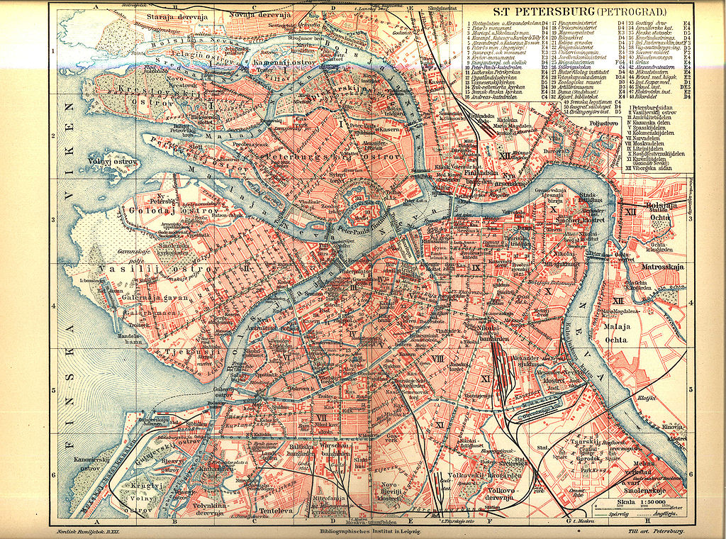
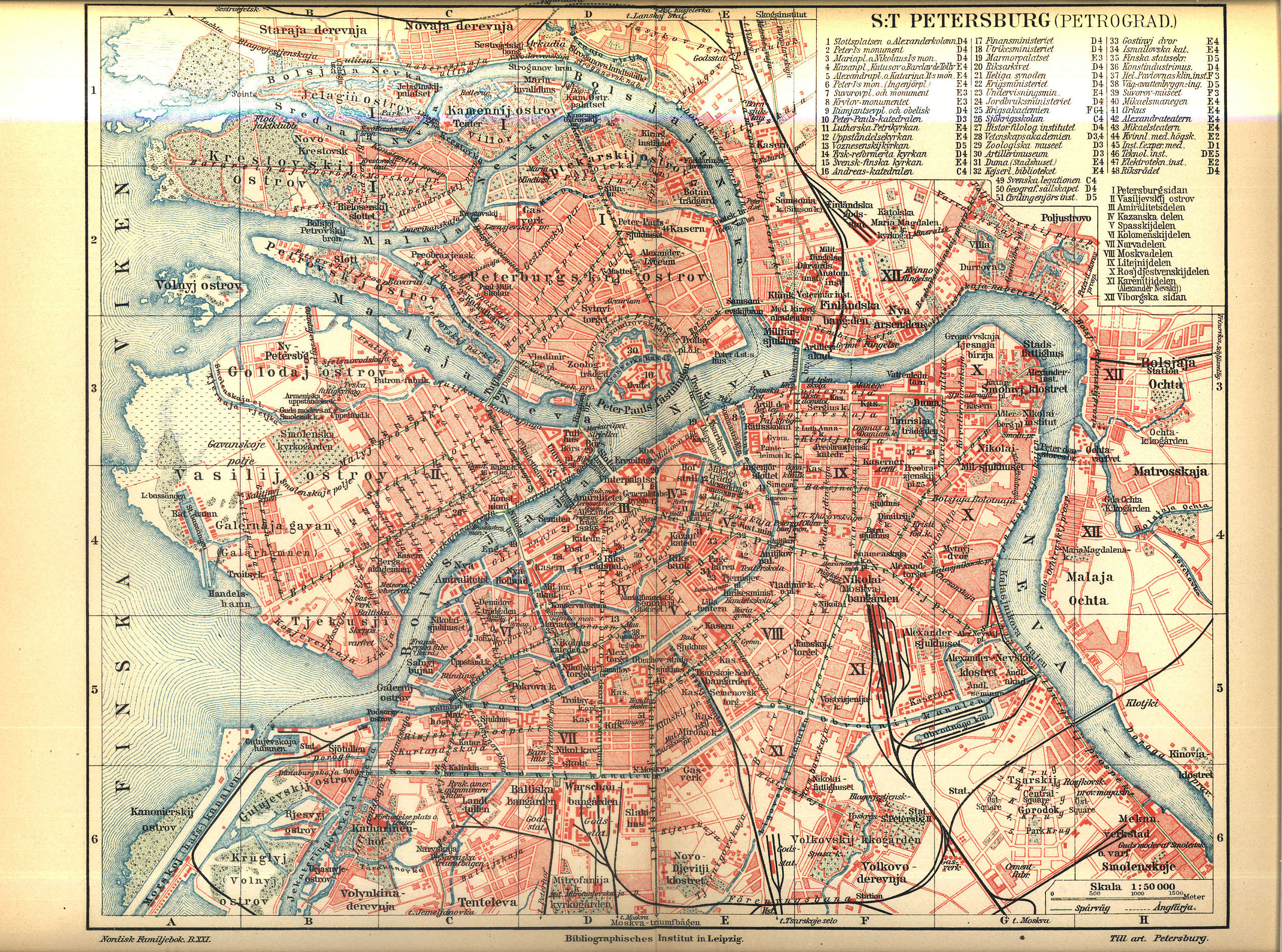
English: Map of Saint Petersburg between 1911 and 1915
Svenska: Karta över Sankt Petersburg på 1910-talet
Русский: Карта Санкт-Петербурга. Между 1911 и 1915. |
||||||||
| Dato | mellom 1911 og 1915 (1911 - opened Peter the Great Bridge over Neva River; 1915 — published volume 21 «Papua - Posselt» of Nordisk familjebok) | ||||||||
| Kilde | Nordisk familjebok | ||||||||
| Opphavsperson |
English: Сonsociation "Prosveschenie", Saint Petersburg Русский: Товарищество "Просвещение", Санкт-Петербург |
||||||||
| Tillatelse (Gjenbruk av denne filen) |
|
||||||||
| Andre versjoner | spkarta.ru, |


.jpg)
| Open this image as an overlay in Google Earth (Google Maps, Bing) | (Help|Source) |
.jpg/overlay.kml)
Filhistorikk
Klikk på et tidspunkt for å vise filen slik den var på det tidspunktet.
| Dato/klokkeslett | Miniatyrbilde | Dimensjoner | Bruker | Kommentar | |
|---|---|---|---|---|---|
| nåværende | 27. apr. 2005 kl. 00:09 | | 3 432 × 2 548 (2,2 MB) | Den fjättrade ankan~commonswiki | *{{Svenska}} Karta över Sankt Petersburg på 1910-talet *{{English}} Map of Saint Petersburg at the 1910s *Source: Nordisk familjebok {{PD-Ugglan}} Category:Saint Petersburg, Russia Category:20th century maps |
Filbruk
Den følgende siden bruker denne filen:
Global filbruk
Følgende andre wikier bruker denne filen:
- Bruk i br.wikipedia.org
- Bruk i es.wikipedia.org
- Bruk i fi.wikipedia.org
- Bruk i fr.wikipedia.org
- Bruk i gl.wikipedia.org
- Bruk i hy.wikipedia.org
- Bruk i ja.wikipedia.org
- Bruk i mn.wikipedia.org
- Bruk i ro.wikipedia.org
- Bruk i sv.wikipedia.org
.jpg)