Fil:Great Chicago Fire map.jpg
Opprinnelig fil (3 588 × 5 382 piksler, filstørrelse: 4,42 MB, MIME-type: image/jpeg)
| Denne filen er fra Wikimedia Commons og kan brukes av andre prosjekter. Informasjonen fra filbeskrivelsessiden vises nedenfor. |
| Beskrivelse |
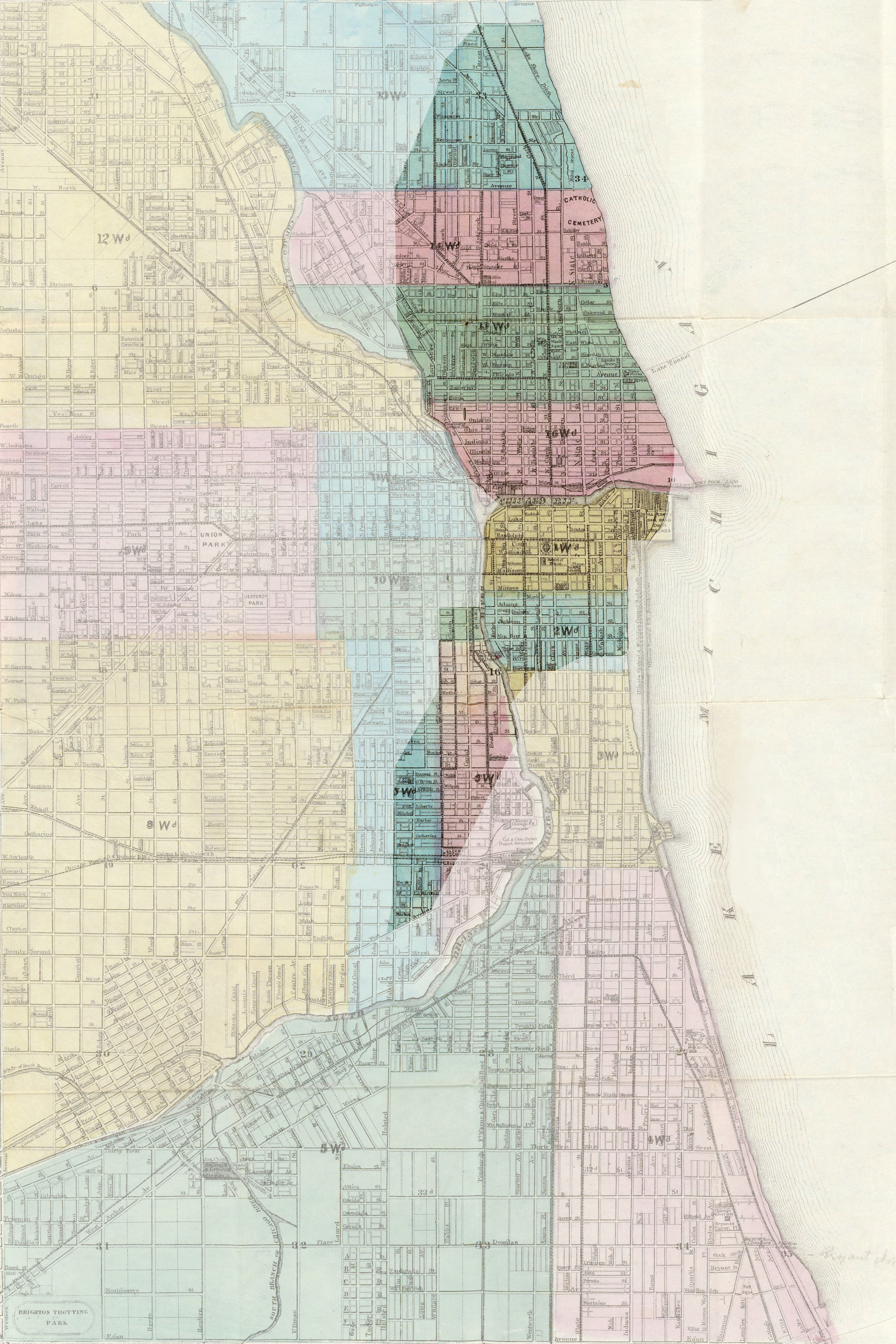
English: Map of Chicago, showing the burned area after the Great Chicago Fire in 1871. Français : Carte de Chicago, montrant la zone incendiée lors du Grand incendie de Chicago en 1871. Deutsch: Stadtplan von Chicago, die dunkle Fläche zeigt das Gebiet, das durch den Großen Brand von Chicago im Jahre 1871 zerstört wurde. |
| Dato | (UTC) |
| Kilde |
|
| Opphavsperson |
|
| Kameraposisjon | | Dette og andre bilder på denne posisjonen på: OpenStreetMap |
|---|
| This is a retouched picture, which means that it has been digitally altered from its original version. Modifications: Mise en valeur de la zone incendiée. The original can be viewed here: 1869 chicago.jpg:
|
|
Dette verket er offentlig eiendom i Norge, EU og land der den opphavsrettslige vernetiden etter opphavsmannens død er 70 år eller kortere. Merk at noen land har lengre vernetid.
| |
| Denne filen har blitt identifisert til å være fri for kjente restriksjoner under lov om opphavsrett, inkludert alle relaterte og nærstående rettigheter. | |
Orginal opplastningslogg
This image is a derivative work of the following images:
- File:1869_chicago.jpg licensed with PD-old
- 2005-08-12T08:01:34Z SPUI 4902x6376 (9280310 Bytes) {{PD}} 1869 map of Chicago from [http://www.davidrumsey.com/ davidrumsey.com]. [[Category:Maps of Chicago]]
Uploaded with derivativeFX
Filhistorikk
Klikk på et tidspunkt for å vise filen slik den var på det tidspunktet.
| Dato/klokkeslett | Miniatyrbilde | Dimensjoner | Bruker | Kommentar | |
|---|---|---|---|---|---|
| nåværende | 17. feb. 2009 kl. 15:03 | | 3 588 × 5 382 (4,42 MB) | Sémhur | {{Information |Description= {{en|Map of Chicago, showing the burned area during the Great Chicago Fire in 1871.}} {{fr|Carte de Chicago, montrant la zone incendiée lors du [[:fr:Grand incendie de Chicago|Grand incendie de Chica |
Filbruk
Den følgende siden bruker denne filen:
Global filbruk
Følgende andre wikier bruker denne filen:
- Bruk i ca.wikipedia.org
- Bruk i da.wikipedia.org
- Bruk i de.wikipedia.org
- Bruk i fr.wikipedia.org
- Bruk i it.wikipedia.org
- Bruk i ja.wikipedia.org
- Bruk i lv.wikipedia.org
- Bruk i pl.wikipedia.org
- Bruk i pt.wikipedia.org
- Bruk i ta.wikipedia.org