Fil:European Union Exclusive Economic Zones.PNG
Størrelse på denne forhåndsvisningen: 767 × 600 piksler. Andre oppløsninger: 307 × 240 piksler | 614 × 480 piksler | 982 × 768 piksler | 1 280 × 1 001 piksler | 2 560 × 2 002 piksler | 4 572 × 3 576 piksler.
Opprinnelig fil (4 572 × 3 576 piksler, filstørrelse: 1,65 MB, MIME-type: image/png)
| Denne filen er fra Wikimedia Commons og kan brukes av andre prosjekter. Informasjonen fra filbeskrivelsessiden vises nedenfor. |
Beskrivelse
| Beskrivelse |
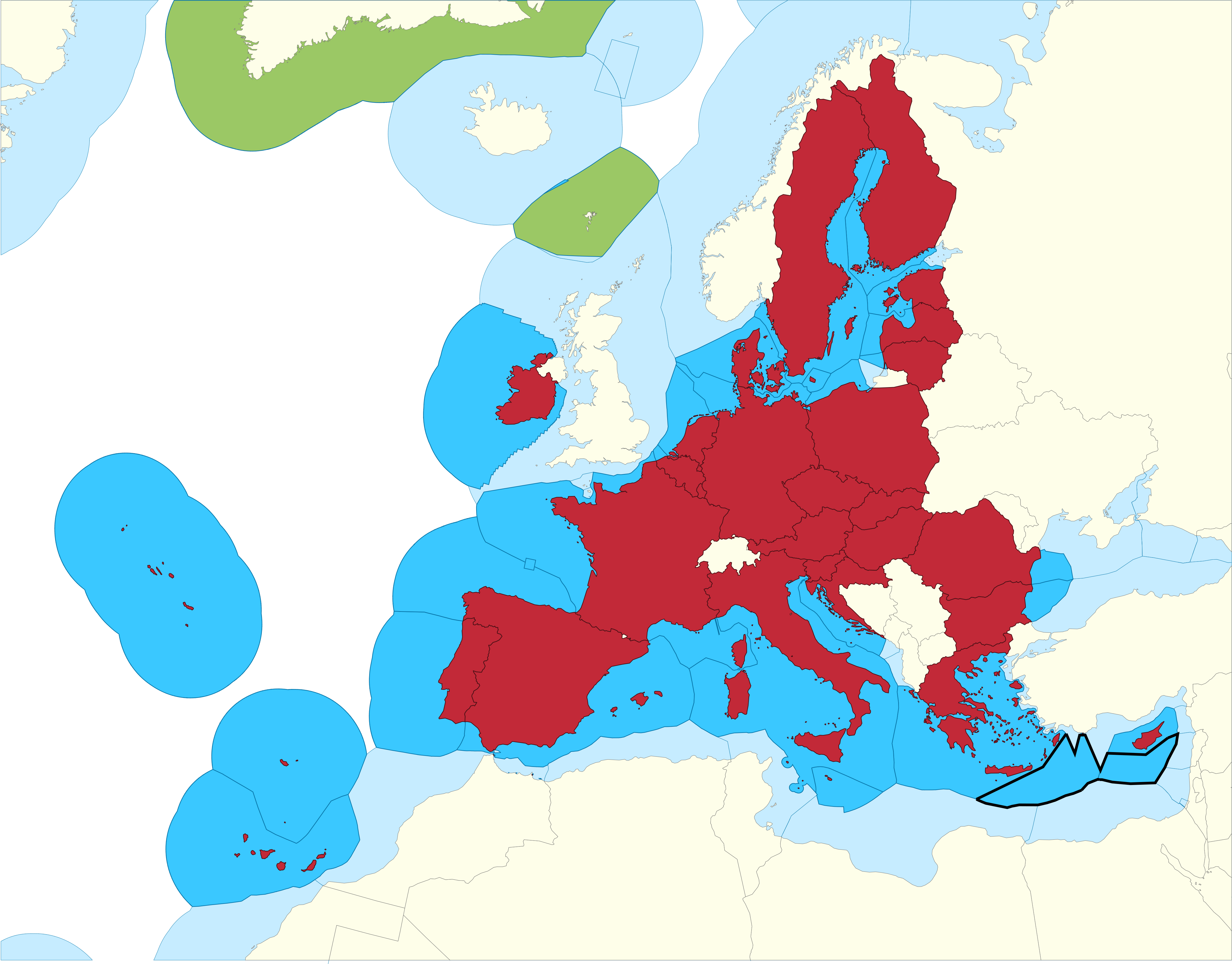
English: European Union Member states Exclusive Economic Zones |
|||
| Dato | ||||
| Kilde |
EU member states Exclusive Economic Zones
EU member states overseas territories Exclusive Economic Zones
EU member states
Disputed Exclusive Economic Zones |
|||
| Opphavsperson | Sette-quattro, replacing the previous work done by Luis_wiki | |||
| Tillatelse (Gjenbruk av denne filen) |
Own work | |||
| Andre versjoner |
|


Lisensiering
| Jeg, opphavsrettensholderen til dette verket, frigir dette verket til allmennheten. Dette gjelder på verdensbasis. I enkelte land kan dette være juridisk umulig. I så fall: Jeg gir hvem som helst retten til å bruke dette verket for ethvert formål, uten noen vilkår, med mindre slike vilkår kreves ved lov. |
Filhistorikk
Klikk på et tidspunkt for å vise filen slik den var på det tidspunktet.
| Dato/klokkeslett | Miniatyrbilde | Dimensjoner | Bruker | Kommentar | |
|---|---|---|---|---|---|
| nåværende | 17. feb. 2021 kl. 13:14 | | 4 572 × 3 576 (1,65 MB) | Ahmetlii | higher resolution |
| 17. feb. 2021 kl. 13:09 |  | 1 280 × 997 (308 KB) | Ahmetlii | added the disputed EEZ border per en:Cyprus–Turkey maritime zones dispute | |
| 8. sep. 2020 kl. 23:33 |  | 4 572 × 3 566 (1,22 MB) | Sette-quattro | updated without UK, clearer boundaries | |
| 16. jul. 2011 kl. 10:54 |  | 485 × 294 (86 KB) | Epipelagic | Somewhat simplified the map | |
| 23. des. 2010 kl. 13:12 |  | 489 × 298 (19 KB) | Begg maps | {{Information |Description={{es|1=-}} |Source=- |Author=- |Date=- |Permission= |other_versions= }} | |
| 28. aug. 2007 kl. 01:31 |  | 489 × 298 (19 KB) | Luis wiki | {{Information |Description= European Union Member states Exclusive Economic Zones |Source= Own work over screen capture of Map Interface of VLIZ Maritime Boundaries Geodatabase (http://w2.vliz.be/vmdcdata/marbound/geointerface.php) |Date= 28 August 2007 |
Filbruk
Den følgende siden bruker denne filen:
Global filbruk
Følgende andre wikier bruker denne filen:
- Bruk i ar.wikipedia.org
- Bruk i ast.wikipedia.org
- Bruk i ca.wikipedia.org
- Bruk i cs.wikipedia.org
- Bruk i en.wikipedia.org
- Bruk i es.wikipedia.org
- Bruk i eu.wikipedia.org
- Bruk i fi.wikipedia.org
- Bruk i he.wikipedia.org
- Bruk i id.wikipedia.org
- Bruk i it.wikipedia.org
- Bruk i ja.wikipedia.org
- Bruk i ko.wikipedia.org
- Bruk i pt.wikipedia.org
- Bruk i sv.wikipedia.org
- Bruk i uk.wikipedia.org
- Bruk i zh.wikipedia.org