Fil:Balkan boundaries1876map1914.png

Opprinnelig fil (984 × 712 piksler, filstørrelse: 73 KB, MIME-type: image/png)
| Denne filen er fra Wikimedia Commons og kan brukes av andre prosjekter. Informasjonen fra filbeskrivelsessiden vises nedenfor. |

|
This map has been uploaded by Electionworld from en.wikipedia.org to enable the |
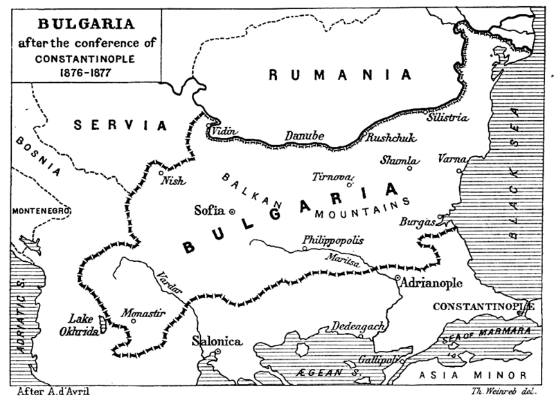
| Beskrivelse | Map from "Report of the International Commission To Inquire into the Causes and Conduct of the Balkan Wars" 1914. |
| Dato | Map printed and published 1914 |
| Kilde | a map |
| Opphavsperson | Source: [1] - JPG to PNG by Iain 09:30, 13 June 2006 (UTC) |
| Tillatelse (Gjenbruk av denne filen) |
Original File PD |
| Andre versjoner | Original Image Image:Balkan boundaries1876map1914.jpg now redundant |
|
Dette verket er offentlig eiendom i Norge, EU og land der den opphavsrettslige vernetiden etter opphavsmannens død er 70 år eller kortere. Merk at noen land har lengre vernetid.
| |
| Denne filen har blitt identifisert til å være fri for kjente restriksjoner under lov om opphavsrett, inkludert alle relaterte og nærstående rettigheter. | |
Filhistorikk
Klikk på et tidspunkt for å vise filen slik den var på det tidspunktet.
| Dato/klokkeslett | Miniatyrbilde | Dimensjoner | Bruker | Kommentar | |
|---|---|---|---|---|---|
| nåværende | 21. des. 2006 kl. 00:17 | | 984 × 712 (73 KB) | Electionworld | {{ew|en|Iain}} {{Information| |Description = Map from "Report of the International Commission To Inquire into the Causes and Conduct of the Balkan Wars" 1914. |Date = Map printed and published 1914 |Author = Source: [http://www.lib.utexas.edu/maps/histori |
Filbruk
Den følgende siden bruker denne filen:
Global filbruk
Følgende andre wikier bruker denne filen:
- Bruk i ar.wikipedia.org
- Bruk i bg.wikipedia.org
- Bruk i bs.wikipedia.org
- Bruk i ca.wikipedia.org
- Bruk i de.wikipedia.org
- Bruk i el.wikipedia.org
- Bruk i en.wikipedia.org
- Bruk i et.wikipedia.org
- Bruk i fa.wikipedia.org
- Bruk i fr.wikipedia.org
- Bruk i hr.wikipedia.org
- Bruk i hu.wikipedia.org
- Bruk i it.wikipedia.org
- Bruk i mk.wikipedia.org
- Bruk i nl.wikipedia.org
- Bruk i pl.wikipedia.org
- Bruk i pt.wikipedia.org
- Bruk i ro.wikipedia.org
- Bruk i simple.wikipedia.org
- Bruk i sk.wikipedia.org
- Bruk i sq.wikipedia.org
- Bruk i sr.wikipedia.org
- Bruk i tr.wikipedia.org
- Bruk i uk.wikipedia.org
- Bruk i www.wikidata.org