Fil:Wales in the UK and Europe.svg

Størrelse for denne PNG-forhåndsvisningen av denne SVG-filen: 713 × 600 piksler Andre oppløsninger: 285 × 240 piksler | 571 × 480 piksler | 913 × 768 piksler | 1 218 × 1 024 piksler | 2 435 × 2 048 piksler | 2 045 × 1 720 piksler.
Opprinnelig fil (SVG-fil, standardstørrelse 2 045 × 1 720 piksler, filstørrelse: 7,84 MB)
| Denne filen er fra Wikimedia Commons og kan brukes av andre prosjekter. Informasjonen fra filbeskrivelsessiden vises nedenfor. |
Beskrivelse
| Beskrivelse |
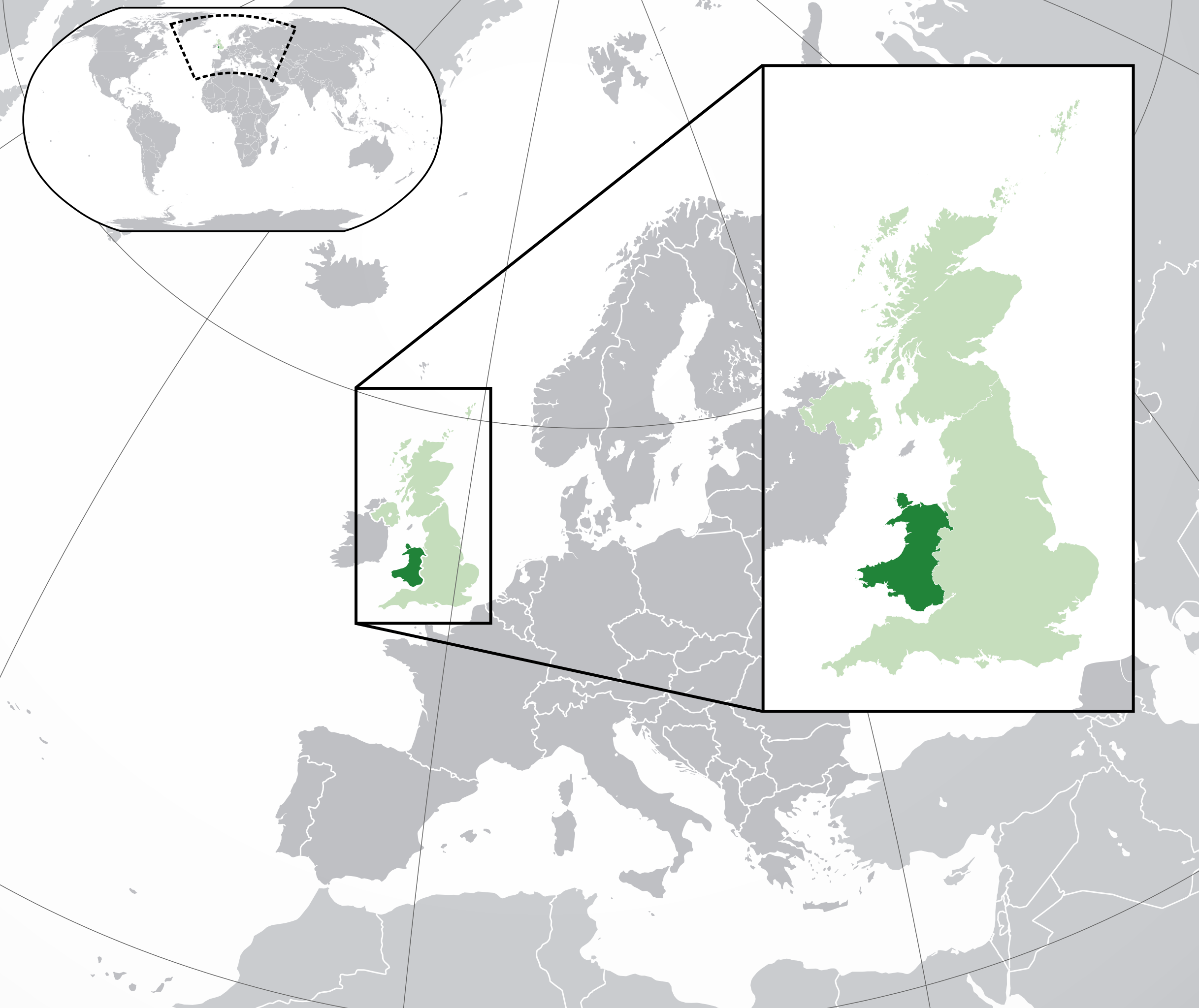
English: A map of Wales within the United Kingdom and Europe. The map is a polar orthographic projection.
Wales
United Kingdom (except Wales)
Europe (except UK) Français : Une carte du Pays de Galles au sein du Royaume-Uni et en Europe. La carte est un polair projection orthographique.
Pays de Galles
Royaume-Uni (sauf le Pays de Galles)
Europe (sauf le Royaume-Uni) Deutsch: Eine Karte der Wales drinnen das Vereinigtes Königreich und drinnen Europa. Die Karte ist ein polare orthografische Azimutalprojektion.
Wales
Vereinigtes Königreich (außer Wales)
Europa (außer das Vereinigtes Königreich) Cymraeg:
Cymru
Y Deyrnas Unedig
Ewrop Gàidhlig:
A' Chuimrigh
An Rìoghachd Aonaichte
An Roinn-Eòrpa Gaeilge:
An Bhreatain Bheag
An Ríocht Aontaithe
An Eoraip Kernowek: Kembra
Ruwvaneth Unys
Europa |
| Dato | (UTC) |
| Kilde |
This file was derived from: Blank map of Europe (with disputed regions).svg: |
| Opphavsperson |
|
| Andre versjoner |
|
| SVG utvikling | Denne store vektorgrafikken ble laget med Inkscape, or with something else. |


.svg)
Lisensiering
Denne filen er lisensiert under lisensen Creative Commons Navngivelse-DelPåSammeVilkår 3.0 Unported
- Du står fritt:
- til å dele – til å kopiere, distribuere og overføre verket
- til å blande – til å endre verket
- Under de følgende betingelsene:
- navngivelse – Du må kreditere verket på passende vis, lenke til lisensen og indikere hvorvidt det har blitt gjort endringer. Du kan gjøre det på enhver rimelig måte, men ikke på en måte som antyder at lisensgiveren støtter deg eller din bruk av verket.
- del på samme vilkår – Dersom du remikser, omarbeider eller på annen måte bygger på dette verket, må du kun distribuere resultatet under den samme eller en samsvarende lisens som denne.
Orginal opplastningslogg
This image is a derivative work of the following images:
- File:Blank_map_of_Europe.svg licensed with Cc-by-sa-2.5
- 2012-02-21T16:27:27Z Alphathon 680x520 (614699 Bytes) Updated Metadata and the boarders/coastlines along the western coast of the Black Sea
- 2011-09-19T22:57:58Z Alphathon 680x520 (603759 Bytes) Added North/Northern Cyprus
- 2011-08-23T10:26:48Z Heb 680x520 (604212 Bytes) Added [[:en:Bornholm]] (taken from [[:File:Denmark blank map.svg]])
- 2011-04-12T00:40:40Z Alphathon 680x520 (602549 Bytes) Upgraded Sicily based on "File:Freeworldmaps-sicily.jpg". Upgraded Malta based on "File:Map of Malta 2.png". Simplified Croatian borders.
- 2011-04-10T21:43:04Z Alphathon 680x520 (607359 Bytes) Upgraded Croatia, Bosnia & Herzegovina, Slovenia and surrounding countries based on data from "File:Kroatien - Politische Gliederung (Karte).png"
- 2011-04-10T20:05:09Z Alphathon 680x520 (568373 Bytes) Improved Serbia, Montenegro and surrounding countries using data from "File:Serbia Map.png". Fixed Serbia-Montenegro border. Added Kosovo (using dashed border, since it is not a universally recognised nation, and left the lan
- 2011-04-10T15:55:02Z Alphathon 680x520 (524980 Bytes) Tweaked Ukraine and surrounding countries based on data from "File:Up-map.png"
- 2011-04-10T04:02:09Z Alphathon 680x520 (511168 Bytes) Improved Greece, Albania, F.Y.R. Macedonia and Bulgaria based on "File:Greece topo.jpg"
- 2011-04-10T02:48:52Z Alphathon 680x520 (505569 Bytes) Tweaked Germany and surrounding countries based on info from "File:Germany_general_map.png"
- 2011-04-10T01:54:05Z Alphathon 680x520 (493733 Bytes) Converted all lakes back to separate layer. Added Finish lakes and tweaked Finland shape based on "File:Finland 1996 CIA map.jpg". Added Swiss lakes based on "File:Suisse cantons.svg". Tweaked Scotland and added Lochs.
- 2011-04-10T00:07:54Z Alphathon 680x520 (450120 Bytes) Improved England outline and added Isle of Wight based on "File:England Regions - Blank.svg". Improved Denmark based on "File:2 digit postcode danmark.png". Improved Sweden based on "File:Map of Sweden, CIA, 1996.jpg"
- 2011-04-08T15:53:07Z Alphathon 680x520 (438878 Bytes) Upgraded/fixed various parts of the map. Details: *Some minor fixes to Ireland and added some of the larger lakes based on [[:File:Ireland_trad_counties_named.svg]] *Pretty major fixes to Scotland (mainly the west coast and i
- 2008-09-17T09:50:25Z F7 680x520 (531491 Bytes)
- 2008-09-17T09:42:57Z F7 680x520 (2353 Bytes)
- 2008-05-26T19:04:07Z Collard 680x520 (531491 Bytes) uploading on behalf of [[User:Checkit]], direct complaints to him plox: 'Moved countries out of the "outlines" group, removed "outlines" style class, remove separate style information for Russia'
- 2008-04-30T01:38:52Z TimothyBourke 680x520 (531767 Bytes) Changed the country code of Serbia to RS per [http://en.wikipedia.org/wiki/Serbian_country_codes] and the file [http://www.iso.org/iso/iso3166_en_code_lists.txt].
- 2008-02-08T22:44:37Z CarolSpears 680x520 (531767 Bytes) validated
- 2007-07-10T11:47:59Z MrWeeble 680x520 (533112 Bytes) Updated to include British Crown Dependencies as seperate entities and regroup them as "British Islands", with some simplifications to the XML and CSS
- 2007-05-14T17:17:34Z Zirland 680x520 (540659 Bytes) serbia and montenegro
- 2007-03-30T20:40:49Z W!B: 680x520 (538830 Bytes) minor corr: update nl:Ijsselmeer, del fi:lakes (all small), add ru:lake Oneka (all ref maps.google), glued northern irland back to ie ;)
- 2007-02-05T18:44:32Z Maix 680x520 (538295 Bytes) cropped
- 2007-02-04T15:07:29Z Maix 680x520 (538310 Bytes) {{Information |Description=A blank Map of Europe in SVG format. Every country has an id which is its ISO-3116-1-ALPHA2 code in lower case for easy coloring. |Source=Image based on [[Image:Europe_countries.svg|]] by [[User:Ti
Uploaded with derivativeFX
Filhistorikk
Klikk på et tidspunkt for å vise filen slik den var på det tidspunktet.
| Dato/klokkeslett | Miniatyrbilde | Dimensjoner | Bruker | Kommentar | |
|---|---|---|---|---|---|
| nåværende | 6. aug. 2014 kl. 22:00 | | 2 045 × 1 720 (7,84 MB) | Rob984 | Improved version: More accurate coastline, borders, etc. Added Gradient and Longitude and latitude lines. Zoom insert centred on UK. |
| 21. feb. 2014 kl. 16:58 |  | 680 × 520 (2,48 MB) | Rob984 | White background so that the edge of the map is clear. Consistency with other European countries' maps also. | |
| 19. jan. 2013 kl. 20:35 |  | 680 × 520 (2,46 MB) | Alphathon | Added Robinson projection to the top left corner. | |
| 27. feb. 2012 kl. 01:37 |  | 680 × 520 (941 KB) | Alphathon | Fixed XML | |
| 27. feb. 2012 kl. 01:35 |  | 680 × 520 (941 KB) | Alphathon | More detailed British Isles | |
| 26. feb. 2012 kl. 02:35 |  | 680 × 520 (790 KB) | Alphathon | Added missing parts of Belgium and the Netherlands. | |
| 26. feb. 2012 kl. 00:36 |  | 680 × 520 (806 KB) | Alphathon | == {{int:filedesc}} == {{Information |Description={{en|A map of Wales (dark green) within the United Kingdom (dark and light green) and Europe (dark green, light green and darker grey).}} |Source={{Derived from|Blank_map_of_Europe.svg|display=50}} |Dat... |
Filbruk
Den følgende siden bruker denne filen:
Global filbruk
Følgende andre wikier bruker denne filen:
- Bruk i af.wikipedia.org
- Bruk i af.wiktionary.org
- Bruk i am.wikipedia.org
- Bruk i ar.wikipedia.org
- Bruk i arz.wikipedia.org
- Bruk i be.wikipedia.org
- Bruk i bg.wikipedia.org
- Bruk i bh.wikipedia.org
- Bruk i blk.wikipedia.org
- Bruk i bs.wikipedia.org
- Bruk i bxr.wikipedia.org
- Bruk i cdo.wikipedia.org
- Bruk i chy.wikipedia.org
- Bruk i ckb.wikipedia.org
- Bruk i csb.wikipedia.org
- Bruk i el.wikipedia.org
- Bruk i en.wikipedia.org
- Bruk i en.wikinews.org
- Bruk i en.wiktionary.org
- Bruk i es.wikipedia.org
- Bruk i et.wikipedia.org
- Bruk i eu.wikipedia.org
- Bruk i fa.wikipedia.org
- Bruk i fiu-vro.wikipedia.org
- Bruk i fi.wikipedia.org
- Bruk i fi.wiktionary.org
- Bruk i fr.wikipedia.org
- Bruk i fy.wikipedia.org
- Bruk i gd.wiktionary.org
- Bruk i gn.wikipedia.org
- Bruk i gu.wikipedia.org
- Bruk i hak.wikipedia.org
- Bruk i he.wikivoyage.org
- Bruk i hi.wikipedia.org
- Bruk i hr.wikipedia.org
- Bruk i hr.wiktionary.org
- Bruk i hu.wikipedia.org
- Bruk i hy.wikipedia.org
- Bruk i ia.wikipedia.org
- Bruk i ilo.wikipedia.org
Vis mer global bruk av denne filen.