Fil:TransCanadaHWY.png
Størrelse på denne forhåndsvisningen: 746 × 599 piksler. Andre oppløsninger: 299 × 240 piksler | 598 × 480 piksler | 860 × 691 piksler.
Opprinnelig fil (860 × 691 piksler, filstørrelse: 156 KB, MIME-type: image/png)
| Denne filen er fra Wikimedia Commons og kan brukes av andre prosjekter. Informasjonen fra filbeskrivelsessiden vises nedenfor. |
Beskrivelse
| Beskrivelse |
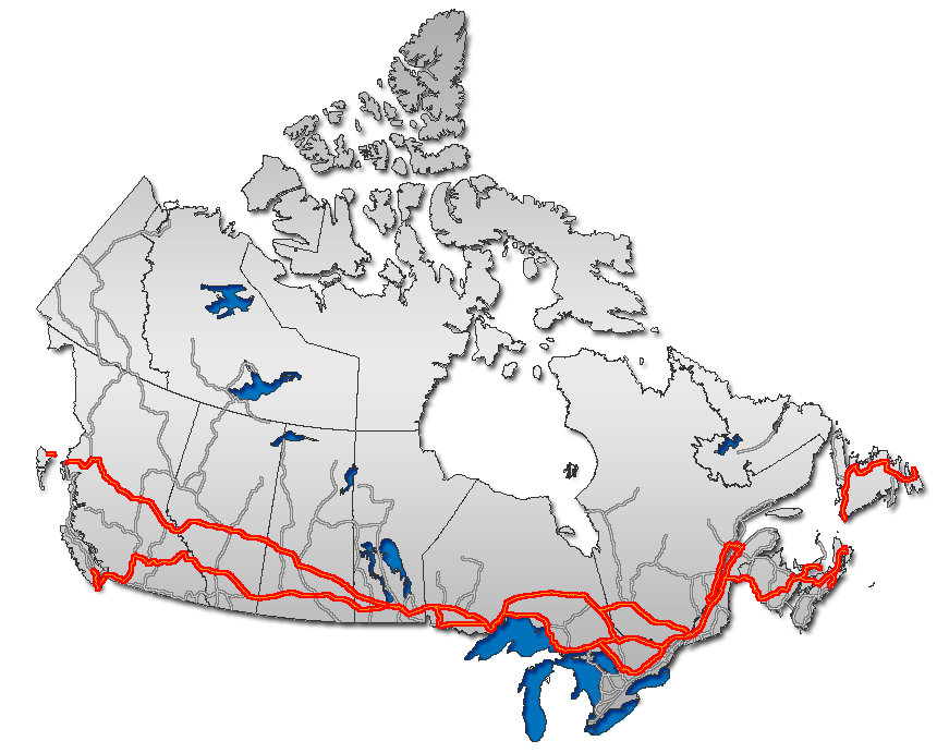
English: Trans Canada Highway, as overlaid on Canada map
Français : Route transcanadienne sur la carte du Canada
Esperanto: Trans-Kanada Ŝoseo sur mapo de Kanado
日本語: トランスカナダハイウェイ地図。
Nederlands: Routemap van de Trans-Canada Highway |
| Dato | |
| Kilde | GIS data |
| Opphavsperson | Qyd (diskusjon · bidrag) |
| Tillatelse (Gjenbruk av denne filen) |
All |
| Andre versjoner |
|


Lisensiering
| Jeg, opphavsrettensholderen til dette verket, frigir dette verket til allmennheten. Dette gjelder på verdensbasis. I enkelte land kan dette være juridisk umulig. I så fall: Jeg gir hvem som helst retten til å bruke dette verket for ethvert formål, uten noen vilkår, med mindre slike vilkår kreves ved lov. |

|
Dette bildet bør gjenskapes med hjelp av vektorgrafikk som en SVG-fil. Dette har flere fordeler, se Commons:Media for cleanup for mer informasjon. Hvis en SVG-fil med dette bildet er tilgjengelig, vennligst last den opp. Etter opplasting erstatt denne malen med {{vector version available|nytt bilde.svg}}.
|
| Annotations | This image is annotated: View the annotations at Commons |
Filhistorikk
Klikk på et tidspunkt for å vise filen slik den var på det tidspunktet.
| Dato/klokkeslett | Miniatyrbilde | Dimensjoner | Bruker | Kommentar | |
|---|---|---|---|---|---|
| nåværende | 24. jan. 2007 kl. 02:39 | | 860 × 691 (156 KB) | Qyd | reload |
| 13. des. 2006 kl. 13:45 |  | 860 × 691 (156 KB) | Qyd | add On hwy 11 and 71 | |
| 13. des. 2006 kl. 04:06 |  | 860 × 691 (156 KB) | Qyd | oops again, forgot about yellowhead | |
| 13. des. 2006 kl. 03:48 |  | 860 × 691 (155 KB) | Qyd | oops, another correction | |
| 13. des. 2006 kl. 03:41 |  | 860 × 691 (155 KB) | Qyd | corrected route, thanks Bearcat | |
| 8. des. 2006 kl. 15:23 |  | 860 × 691 (157 KB) | Qyd | add major road network shadow | |
| 21. nov. 2006 kl. 23:19 |  | 860 × 691 (142 KB) | Qyd | complete canada contour, UTM projection | |
| 30. okt. 2006 kl. 11:53 |  | 677 × 300 (17 KB) | Matt314 | corrections by User:Bearcat: minor inaccuracy in Ontario (Highway 11 is not TCH south of North Bay; Hwy 400 is not TCH south of Coldwater.) | |
| 22. feb. 2006 kl. 01:07 |  | 677 × 300 (18 KB) | Qyd | ||
| 17. feb. 2006 kl. 01:47 |  | 693 × 312 (22 KB) | Qyd | Trans Canada Highway. Category:Maps_of_CanadaCategory:Highways_in_Canada |
Filbruk
Den følgende siden bruker denne filen:
Global filbruk
Følgende andre wikier bruker denne filen:
- Bruk i ar.wikipedia.org
- Bruk i ca.wikipedia.org
- Bruk i de.wikipedia.org
- Bruk i en.wikipedia.org
- Trans-Canada Highway
- Confederation Bridge
- Numbered highways in Canada
- Yellowhead Highway
- British Columbia Highway 16
- British Columbia Highway 1
- Ontario Highway 17
- Ontario Highway 11
- Ontario Highway 7
- New Brunswick Route 2
- Ontario Highway 417
- Ontario Highway 400
- CFB Shilo
- Ontario Highway 69
- Quebec Autoroute 20
- Quebec Autoroute 40
- Quebec Autoroute 15
- Quebec Autoroute 25
- Quebec Route 185
- Alberta Highway 16
- New Brunswick Route 16
- Alberta Highway 1
- Nova Scotia Highway 104
- Nova Scotia Highway 105
- Nova Scotia Highway 106
- Perimeter Highway (Winnipeg)
- Manitoba Highway 1
- Newfoundland and Labrador Route 1
- Manitoba Highway 16
- Template:Trans-Canada
- Talk:Trans-Canada Highway
- User talk:Qyd
- Prince Edward Island Route 1
- Saskatchewan Highway 1
- Saskatchewan Highway 16
- Quebec Route 117
- Ontario Highway 12
- Ontario Highway 66
- Ontario Highway 71
- Quebec Autoroute 85
- Portal:Roads/Did you know
- Ontario Highway 17A
- Ministry of Highways and Infrastructure (Saskatchewan)
- Regina Bypass
- Wikipedia:Graphics Lab/Map workshop/Archive/Apr 2019
- Bruk i eo.wikipedia.org
Vis mer global bruk av denne filen.