Fil:Teterboro airport diagram.svg

Størrelse for denne PNG-forhåndsvisningen av denne SVG-filen: 391 × 600 piksler Andre oppløsninger: 156 × 240 piksler | 313 × 480 piksler | 500 × 768 piksler | 667 × 1 024 piksler | 1 335 × 2 048 piksler | 500 × 767 piksler.
Opprinnelig fil (SVG-fil, standardstørrelse 500 × 767 piksler, filstørrelse: 581 KB)
| Denne filen er fra Wikimedia Commons og kan brukes av andre prosjekter. Informasjonen fra filbeskrivelsessiden vises nedenfor. |
| Beskrivelse |
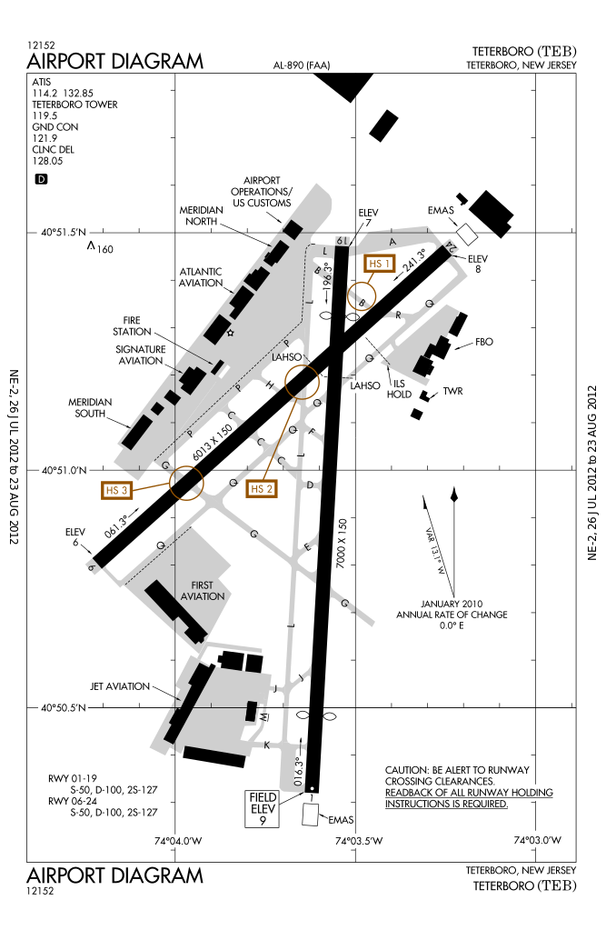
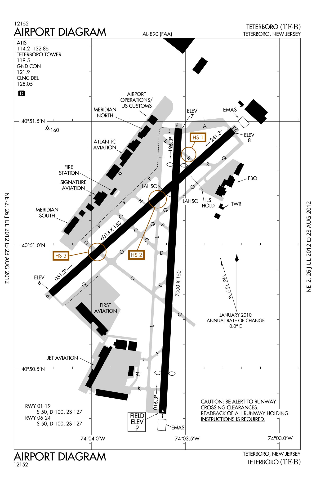
English: FAA airport diagram for Teterboro Airport (TEB) in Teterboro, New Jersey, United States |
|||
| Dato | Effective 2012-07-26 to 2012-08-23 | |||
| Kilde |
[1] Note that this URL changes every 28 days; the airport article should contain a link to the current FAA diagram. |
|||
| Opphavsperson | Produced by the National Aeronautical Charting Office (NACO), a department of the Federal Aviation Administration (FAA) | |||
| Tillatelse (Gjenbruk av denne filen) |
|

Filhistorikk
Klikk på et tidspunkt for å vise filen slik den var på det tidspunktet.
| Dato/klokkeslett | Miniatyrbilde | Dimensjoner | Bruker | Kommentar | |
|---|---|---|---|---|---|
| nåværende | 31. jul. 2012 kl. 07:23 | | 500 × 767 (581 KB) | Renamed user KdYpUvMgT | size |
| 31. jul. 2012 kl. 07:14 |  | 387 × 594 (581 KB) | Renamed user KdYpUvMgT | {{Information |Description ={{en|1=FAA airport diagram for Teterboro Airport (TEB) in Teterboro, New Jersey, United States}} |Source =[http://aeronav.faa.gov/d-tpp/1208/00890AD.PDF]<br />Note that this URL changes [... |
Filbruk
Den følgende siden bruker denne filen:
Global filbruk
Følgende andre wikier bruker denne filen:
- Bruk i en.wikipedia.org
- Bruk i id.wikipedia.org
- Bruk i it.wikipedia.org
- Bruk i ja.wikipedia.org
- Bruk i ur.wikipedia.org