Fil:MountAkutan.jpg

Størrelse på denne forhåndsvisningen: 800 × 538 piksler. Andre oppløsninger: 320 × 215 piksler | 640 × 430 piksler | 1 024 × 688 piksler.
Opprinnelig fil (1 024 × 688 piksler, filstørrelse: 247 KB, MIME-type: image/jpeg)
| Denne filen er fra Wikimedia Commons og kan brukes av andre prosjekter. Informasjonen fra filbeskrivelsessiden vises nedenfor. |
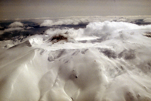
Aerial view of Akutan volcano that forms the west part of Akutan Island in the eastern Aleutian Islands. The volcano's summit is truncated by a 2-km-wide (1.2 mi) caldera that contains a cinder cone that has been the site of frequent historical eruptions. View is to the southeast.
Photograph by C. Nye, Alaska Division of Geological and Geophysical Surveys, May 10, 1994. Source: http://geopubs.wr.usgs.gov/dds/dds-40/
This image is in the public domain in the United States because it only contains materials that originally came from the United States Geological Survey, an agency of the United States Department of the Interior. For more information, see the official USGS copyright policy.
|
Filhistorikk
Klikk på et tidspunkt for å vise filen slik den var på det tidspunktet.
| Dato/klokkeslett | Miniatyrbilde | Dimensjoner | Bruker | Kommentar | |
|---|---|---|---|---|---|
| nåværende | 28. jan. 2005 kl. 14:55 | | 1 024 × 688 (247 KB) | GarciaB~commonswiki | Mount Akutan, Alaska |
Filbruk
Den følgende siden bruker denne filen:
Global filbruk
Følgende andre wikier bruker denne filen:
- Bruk i ca.wikipedia.org
- Bruk i ceb.wikipedia.org
- Bruk i cs.wikipedia.org
- Bruk i de.wikipedia.org
- Bruk i en.wikipedia.org
- Bruk i es.wikipedia.org
- Bruk i eu.wikipedia.org
- Bruk i fi.wikipedia.org
- Bruk i ga.wikipedia.org
- Bruk i gv.wikipedia.org
- Bruk i hy.wikipedia.org
- Bruk i it.wikipedia.org
- Bruk i ms.wikipedia.org
- Bruk i nl.wikipedia.org
- Bruk i uk.wikipedia.org
- Bruk i ur.wikipedia.org
- Bruk i www.wikidata.org
- Bruk i zh.wikipedia.org