Fil:Galapagos-satellite-2002.jpg
Størrelse på denne forhåndsvisningen: 800 × 600 piksler. Andre oppløsninger: 320 × 240 piksler | 640 × 480 piksler | 1 024 × 768 piksler | 1 280 × 960 piksler | 1 600 × 1 200 piksler.
Opprinnelig fil (1 600 × 1 200 piksler, filstørrelse: 387 KB, MIME-type: image/jpeg)
| Denne filen er fra Wikimedia Commons og kan brukes av andre prosjekter. Informasjonen fra filbeskrivelsessiden vises nedenfor. |
Beskrivelse
| Beskrivelse |
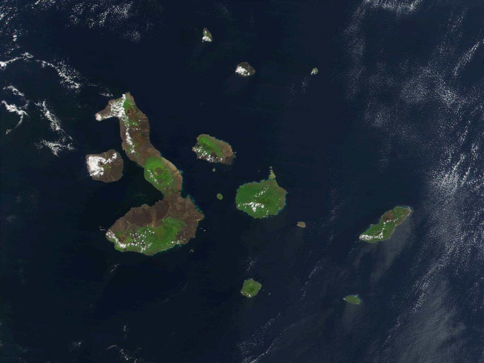
English: This true-color image of the Galapagos Islands was acquired on March 12, 2002, by the Moderate-resolution Imaging Spectroradiometer (MODIS), flying aboard NASA's Terra satellite. The Galapagos Islands, which are part of Ecuador, sit in the Pacific Ocean about 1000 km (620 miles) west of South America. As the three craters on the largest island (Isabela Island) suggest, the archipelago was created by volcanic eruptions, which took place millions of years ago. |
| Dato | |
| Kilde | Earth Observatory 8270 and NASA GSFC |
| Opphavsperson | Jacques Descloitres, MODIS Rapid Response Project at NASA/GSFC |
Lisensiering
| This file is in the public domain in the United States because it was solely created by NASA. NASA copyright policy states that "NASA material is not protected by copyright unless noted". (See Template:PD-USGov, NASA copyright policy page or JPL Image Use Policy.) | ||
 |
Warnings:
|
| Annotations | This image is annotated: View the annotations at Commons |
Filhistorikk
Klikk på et tidspunkt for å vise filen slik den var på det tidspunktet.
| Dato/klokkeslett | Miniatyrbilde | Dimensjoner | Bruker | Kommentar | |
|---|---|---|---|---|---|
| nåværende | 25. nov. 2007 kl. 23:13 | | 1 600 × 1 200 (387 KB) | CarolSpears | {{Information |Description= This true-color image of the Galapagos Islands was acquired on March 12, 2002, by the Moderate-resolution Imaging Spectroradiometer (MODIS), flying aboard NASA's Terra satellite. The Galapagos Islands, which are part of Ecuador |
Filbruk
De følgende 4 sidene bruker denne filen:
Global filbruk
Følgende andre wikier bruker denne filen:
- Bruk i af.wikipedia.org
- Bruk i als.wikipedia.org
- Bruk i an.wikipedia.org
- Bruk i ast.wikipedia.org
- Bruk i azb.wikipedia.org
- Bruk i bg.wikipedia.org
- Bruk i bn.wikipedia.org
- Bruk i br.wikipedia.org
- Bruk i ca.wikipedia.org
- Bruk i cs.wikipedia.org
- Bruk i de.wikipedia.org
- Bruk i de.wikinews.org
- Bruk i en.wikipedia.org
- Bruk i en.wikivoyage.org
- Bruk i en.wiktionary.org
- Bruk i eo.wikipedia.org
- Bruk i es.wikipedia.org
- Bruk i frr.wikipedia.org
- Bruk i fr.wikipedia.org
- Bruk i hu.wikipedia.org
- Bruk i hy.wikipedia.org
- Bruk i incubator.wikimedia.org
- Bruk i it.wikipedia.org
- Bruk i ja.wikipedia.org
- Bruk i jv.wikipedia.org
Vis mer global bruk av denne filen.