Fil:1631 Blaeu Map of the British Isles (England, Scotland, Ireland) - Geographicus - BritanniaeHiberniae-blaeu-1631.jpg

Opprinnelig fil(4 500 × 3 561 piksler, filstørrelse: 5,17 MB, MIME-type: image/jpeg)


Wikimedia Commons' logo
Willem Janszoon Blaeu: Latina: Magnae Britanniae et Hiberniae Tabula.

English: Map of Great Britain and Ireland.

  (Wikidata search (Cirrus search) Wikidata query (SPARQL)  Create new Wikidata item based on this file)
Kunstner
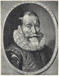
Willem Janszoon Blaeu  (1571–1638)  wikidata:Q520327
 
Willem Janszoon Blaeu
Alternative navn
Willem Janszoon Blaeu, Willem Jansz Blaeu, Guilielmus Janssonius, Willems Jans Zoon, Guilielmus or G. Blaeu
Beskrivelse hollandsk kartograf, forlegger, instrumentmaker, astronom og grafiker
Fødsels-/dødsdato 1571 Redigere på wikidata 18. oktober 1638 / 1638 Redigere på wikidata
Føde-/dødssted Uitgeest Amsterdam
Arbeidsperiode 1610 Redigere på wikidata
Arbeidssted
Amsterdam (1599–1638); Amsterdam Redigere på wikidata
Autoritetsregister
artist QS:P170,Q520327
Tittel
Latina: Magnae Britanniae et Hiberniae Tabula.
English: Map of Great Britain and Ireland.
Beskrivelse
English: This is Guillaume Blaeu’s 1631 map of the British Isles. Covers all of England, Scotland, Wales, and Ireland with adjacent parts of France and Holland and an inset of the Orkney Islands. Cartographically this map is based upon the plates of Jodocus Hondius, which Blaeu acquired in 1629. The original plate drawn by Hondius in 1617, had decorative border images surrounding the map, but Blaeu was forced to reformat the map, sans images, for issue in his seminal Atlas Major. This map would become Blaeu’s standard representation of the British Isles and was published in most subsequent Blaeu atlases issued between 1634 and 1672. A sharp crisp impression suggests an early strike.
Dato 1631 (undated)
Dimensjoner høyde: 15,5 in (39,3 cm); bredde: 20 in (50,8 cm)
dimensions QS:P2048,15.5U218593
dimensions QS:P2049,20U218593
Museumsnummer
Geographicus link: BritanniaeHiberniae-blaeu-1631
Kilde/Fotograf

Blaeu, G., Atlas Major, 1634 - 1672. Also issued independently and in all of Blaue's atlases of the British Isles from 1645 on.

Tillatelse
(Gjenbruk av denne filen)
This is a faithful photographic reproduction of a two-dimensional, public domain work of art. The work of art itself is in the public domain for the following reason:
Public domain

Dette verket er offentlig eiendom i Norge, EU og land der den opphavsrettslige vernetiden etter opphavsmannens død er 100 år eller kortere. Merk at noen land har lengre vernetid.


For å kunne lagres på Commons må verket både være offentlig eiendom i USA og i opphavslandet. Vernetiden kan i noen tilfeller være lengre enn 80 år i USA, så i tillegg til dette merket trengs det et eget merke som forklarer hvorfor verket er offentlig eiendom (public domain) i USA.
The official position taken by the Wikimedia Foundation is that "faithful reproductions of two-dimensional public domain works of art are public domain".
This photographic reproduction is therefore also considered to be in the public domain in the United States. In other jurisdictions, re-use of this content may be restricted; see Reuse of PD-Art photographs for details.

Bildetekster

Legg til en kort forklaring på hva filen representerer

Elementer som er med i denne fila

motiv

image/jpeg

b78ca3659150f63fb02fdc579aa54460c39efe74

5 423 185 byte

3 561 piksel

4 500 piksel

Filhistorikk

Klikk på et tidspunkt for å vise filen slik den var på det tidspunktet.

Dato/klokkeslettMiniatyrbildeDimensjonerBrukerKommentar
nåværende25. mar. 2011 kl. 05:56Miniatyrbilde av versjonen fra 25. mar. 2011 kl. 05:564 500 × 3 561 (5,17 MB)BotMultichillT{{subst:User:Multichill/Geographicus |link=http://www.geographicus.com/P/AntiqueMap/BritanniaeHiberniae-blaeu-1631 |product_name=1631 Blaeu Map of the British Isles (England, Scotland, Ireland) |map_title=Magnae Britanniae et Hiberniae Tabula. |descriptio

Den følgende siden bruker denne filen:

Global filbruk

Følgende andre wikier bruker denne filen: