Fil:VictoriaIslandMap.png
Ingen høyere oppløsning tilgjengelig.
VictoriaIslandMap.png (504 × 540 piksler, filstørrelse: 27 KB, MIME-type: image/png)
| Denne filen er fra Wikimedia Commons og kan brukes av andre prosjekter. Informasjonen fra filbeskrivelsessiden vises nedenfor. |
Beskrivelse
| Beskrivelse |
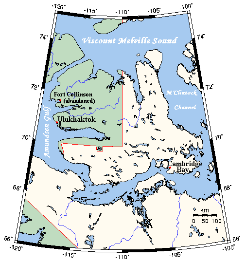
English: A map Victoria Island, Canada |
| Dato | not specified |
| Kilde | This map's source is here, with the uploader's modifications, and the GMT homepage says that the tools are released under the GNU General Public License |
| Opphavsperson | Kelisi at en.wikipedia |
Lisensiering
Kelisi from en.wikipedia.org, rettighetsinnehaver av dette arbeidet, publiserer det herved under følgende lisens:
| Denne filen er lisensiert under lisensen Creative Commons Navngivelse-DelPåSammeVilkår 3.0 Unported Subject to disclaimers. | ||
| Navngivelse: Kelisi from en.wikipedia.org | ||
| ||
| Dette lisensmerket ble lagt til filen som del av lisensoppdateringen av GFDL. |

|
Det tillates at dette dokumentet kopieres, distribueres og/eller modifiseres under retningslinjene som beskrevet i GNU fri dokumentasjonslisens, versjon 1.2 eller senere utgave utgitt av Free Software Foundation; med alle seksjoner, uten noen forsidetekster og baksidetekster. En kopi av lisensen er inkludert i avsnittet GNU Free Documentation License. Subject to disclaimers. |
Orginal opplastningslogg
All following user names refer to en.wikipedia.
- 2006-03-25 03:16 Kelisi 504×540×8 (21 KB) (A map of Victoria Island in the Northwest Territories and Nunavut. This map's source is [http://www.aquarius.geomar.de/omc/make_map.html here], with the uploader's modifications, and the [http://gmt.soest.hawaii.edu/ GMT homepage] says that the tools are )
Filhistorikk
Klikk på et tidspunkt for å vise filen slik den var på det tidspunktet.
| Dato/klokkeslett | Miniatyrbilde | Dimensjoner | Bruker | Kommentar | |
|---|---|---|---|---|---|
| nåværende | 31. jan. 2021 kl. 03:53 | | 504 × 540 (27 KB) | Kelisi | Oops! That was silly. Sorry, I'll try again.......... |
| 31. jan. 2021 kl. 03:50 |  | 504 × 540 (27 KB) | Kelisi | Inhabited hamlets' names have been rendered in bigger type (Fort Collinson has been left smaller), and the local name Ulukhaktok has replaced the former, English name Holman, since the article about the place now has that title. | |
| 13. aug. 2008 kl. 13:32 |  | 504 × 540 (21 KB) | Telim tor | == Information == {{Information |Description={{en|A map Victoria Island, Canada}} |Source=This map's source is [http://www.aquarius.ifm-geomar.de/ here], with the uploader's modifications, and the [http://gmt.soest.hawaii.edu/ GMT homepage] says that the |
Filbruk
Den følgende siden bruker denne filen:
Global filbruk
Følgende andre wikier bruker denne filen:
- Bruk i af.wikipedia.org
- Bruk i bg.wikipedia.org
- Bruk i bs.wikipedia.org
- Bruk i ca.wikipedia.org
- Bruk i ckb.wikipedia.org
- Bruk i da.wikipedia.org
- Bruk i en.wikipedia.org
- Bruk i eo.wikipedia.org
- Bruk i es.wikipedia.org
- Bruk i fa.wikipedia.org
- Bruk i gl.wikipedia.org
- Bruk i hu.wikipedia.org
- Bruk i ilo.wikipedia.org
- Bruk i nn.wikipedia.org
- Bruk i pl.wikipedia.org
- Bruk i ro.wikipedia.org
- Bruk i th.wikipedia.org
- Bruk i tt.wikipedia.org
- Bruk i www.wikidata.org
- Bruk i zh.wikipedia.org